



 $29 UPS Ground Shipping
Due to its size and weight, this item does incur a shipping charge to offset the total shipping cost.
Condition:
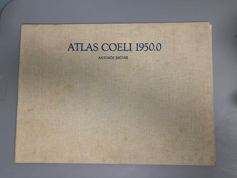
This is the very rare and much sought after Atlas Coeli from its original 1962 printing. It is in very good condition, without a mark on it, inside or out. The inside pages are crisp and clean. It includes the transparency for measuring and an index strip for identifying items. See the photos.
This is available for pickup in our showroom; we also have the box to ship it to you; because of its unusual size, there is a shipping charge of $29. There are no returns on this item.
The Skalnaté Pleso Atlas of the Heavens (Atlas Coeli Skalnaté Pleso 1950.0) is a set of 16 celestial charts covering the entire sky. It is named after the Skalnaté Pleso Observatory in Slovakia where it was produced. The first versions were published by the Czechoslovak Astronomical Society in 1948; later that year, Sky Publishing Corporation acquired the copyright and began publication in the United States. The charts were hand-drawn by Antonín Bečvář.
At the time it was first published, the Atlas Coeli was unique in that it contained essentially all non-stellar objects (star clusters, galaxies etc.) that were visible in an 8-inch telescope, in addition to stars brighter than magnitude 7.75. Until the mid-1970s when it went out of print, the Atlas was extremely popular among amateur astronomers, especially those engaged in comet hunting and the study of variable stars. The Atlas Coeli was also widely used by professional astronomers. Many astronomical observatories still contain copies.
The Atlas Coeli covers both hemispheres with 16 charts. The coordinate system is referred to equinox 1950.0 and the scale is 1° = 0.75 cm. There are six charts of the equatorial regions on a rectangular graticule, covering declinations from +25° to -25°; four charts for each hemisphere with straight, converging hour circles and concentric, equally-spaced declination circles covering declinations 20° - 65°; and, for each hemisphere, a circumpolar chart covering declination 65° to the pole. All stars brighter than 7.75 magnitude are included, for a total of 32,571. The stellar magnitudes are indicated by circles with graded sizes. Double and multiple stars are identified and visual binaries are differentiated from spectroscopic binaries. All known variable stars are identified, including novae that had maxima brighter than magnitude 7.75 (totalling 443). 249 star clusters are shown and their relative size indicated. All known globular clusters are shown. 1,130 extragalactic systems are included as are many Galactic objects including planetary nebulae. Bright and dark diffuse nebulae are shown, and the actual outlines of those larger than 10' in diameter are painstakingly drawn. The Milky Way and prominent obscuring clouds within it are indicated by isophotic lines. Constellation boundaries are clearly but unobtrusively drawn. The celestial equator and ecliptic are indicated. The brightest radio sources are also shown.
The Atlas Coeli is famous for its clean appearance and for the wealth of data it contains. The drawing is beautifully and precisely done and the printing is excellent.[1] Many other star charts have been strongly influenced by the style of the Atlas Coeli. For instance, the popular Sky Atlas 2000.0 of Wil Tirion adopted the symbols for various types of objects, the division of scales, and the script directly from the Atlas Coeli.[2]